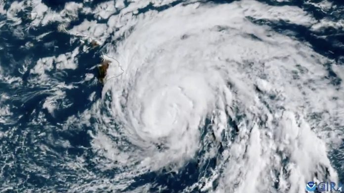
Late Saturday, Hurricane Hone was situated south of Hawaii’s Big Island as a weak Category 1 storm, with sustained winds of 75 mph.
The storm was projected to maintain this intensity, hovering between tropical storm and hurricane status through Sunday and into Monday. Hurricanes are defined by winds of 74 mph or higher.
Hone was moving westward at 12 mph and was located approximately 105 miles south of Hilo, Hawaii, according to the National Hurricane Center.
Hurricane-force winds were extending only about 15 miles from the storm’s center, meaning the Big Island was experiencing tropical storm conditions and was expected to continue doing so. Tropical storm-force winds extended up to 125 miles.
As Hone approached Hawaii, a Tropical Storm Warning was issued and remained in effect for Hawaii County as of 11 p.m. on Saturday, according to weather officials.

Although the storm is not expected to make a direct landfall on the islands, its proximity could still bring potentially hazardous conditions. Tropical storm conditions are likely on the Big Island overnight and into early Sunday, particularly in higher elevations and mountain passes.
Read More: Former Tennessee Officer Charged in Tyre Nichols’ Death Set to Change Plea
Rainfall totals of 6 to 12 inches are expected on the Big Island, especially near windward and southeast-facing slopes, prompting a Flash Flood Watch. Smaller islands could see 2 to 4 inches of rain.
Additionally, life-threatening surf and rip currents are affecting Hawaii.

